KMU innovativ: KiesVision
Duration: 01.08.2023 - 31.07.2025
The overarching goal of the project is to make the operation of individual gravel pits more sustainable by extending their usage period without expansion, following the principle of “depth before surface.” This requires, on the one hand, a technically innovative approach to handling overlying sediment layers and, on the other hand, novel exploration methods for residual gravel quantities. A longer usage duration and more efficient gravel extraction from existing dredging lakes have a range of important positive impacts. Socio-economically, this can ease or improve the regional supply situation with primary mineral raw materials (sand, gravel, concrete). Delayed or avoided lake expansions generally meet with high public acceptance and also represent a more ecologically sound approach to landscape management. In this sense, KiesVision aims to achieve fundamental advances in the future management of silted dredging lakes. The project also considers water bodies facing comparable siltation or silting issues, particularly Alpine reservoirs, which are increasingly impaired by accumulated sediments and urgently require intelligent sediment removal solutions.
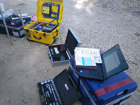
In detail, KiesVision targets the development of automated, as far as possible autonomous, hydroacoustic classification of surface sediments and the integration of this information into the workflow for intelligent dredging (excavation/desilting). For this purpose, campaign concepts for using drone boats in classification will be tested. Sediment classification (by grain size) could support intelligent dredging, in which the excavation tool (e.g., suction head) is regulated and controlled according to sediment conditions.
Another goal is the prototype use of a novel UHRS (Ultra High Resolution Seismic) system in a dredging lake, which is specially provided for this project. This system is intended to penetrate the compact gravel-sand deposits beneath the mud layer in the dredging lake, thereby enabling an acoustic deposit model for the first time. The different acoustic and sedimentological data are available in varying resolutions and formats and are not fundamentally compatible or comparable. A key step is the AI-supported evaluation and fusion of this data into a usable dataset. The digitized and fused three-dimensional exploration results are then to be integrated into the block model (MARPO) of SPE GmbH. This project thus aims to lay the foundations for the development of autonomous and energy-efficient dredging.
The results serve two main functions: on the one hand, they form the basis for immediate improvements in deposit extraction, and on the other hand, they are used to develop solution concepts and water rights applications that ensure sustainable use in the future.
In addition to the goals mentioned, the project results are intended to serve other purposes. It is planned to present the results in scientific publications and at specialist conferences and to incorporate them into university education, such as lectures on remote sensing and machine learning. Furthermore, based on the results, it will be examined to what extent they are transferable to reservoirs.